

TL;DR: Earthwork verification is just checking how much dirt actually got cut, filled, or hauled on your site, then comparing that to what your earthwork contractor billed you. With drone mapping, you can do it every month instead of waiting until closeout to find out something was off.
If you’re developing a 30+ lot community, dirt is probably one of your biggest line items. It’s also one of the hardest to check. Most developers we talk to are approving pay apps (your contractor’s monthly payment requests) off truck counts and the contractor’s own numbers, and hoping it all lines up.
Most of the time it does. Sometimes it really doesn’t.
What Is Earthwork Verification?
It’s an independent check on how much material moved. You’re basically answering three questions:
- How much did we cut?
- How much did we fill?
- How much got hauled on or off site?
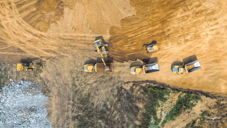
The traditional way to answer those is rod-and-level surveys or GPS shots on a grid. That’s accurate, but it’s slow, so it usually only happens at big milestones. Not every month, and definitely not before every pay app.
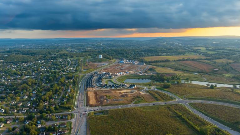
A drone can capture the whole site in one visit. We turn that into a high-accuracy 3D surface and compare it to an earlier flight or to your grading plan.
Why Earthwork Verification Matters on Unit-Price Jobs
On a unit-price dirt contract, more volume means a bigger bill. If nobody’s measuring, you don’t have a great way to know if the quantities you’re paying for match what’s actually happening on the ground.
We’ve run into this ourselves. On one Tennessee project, our monthly drone scans showed a trucking contractor had billed about $450K more dirt than it actually moved. Without those monthly surfaces, that would’ve been really easy to miss.
Not every job has a problem like that. But you won’t know until you measure.
How Accurate Are Drone Volumes?
Accurate enough to settle most quantity questions, as long as the flight and processing are done right.
One study in the Journal of Surveying Engineering compared drone volumes to GPS-based volumes on the same stockpile. The drone numbers came in 2.6% and 3.9% lower than the GPS numbers for the before and after surfaces.
A 2022 case study in Sustainability looked at a building excavation and found only a 0.71% difference between the GPS-estimated volume and the drone-measured volume.
We’ve been tested on this ourselves, without knowing it. A client once had a licensed surveyor measure a roughly 2,680 cubic yard stockpile so he could compare their number to ours. Our drone volume came within 10 cubic yards. That’s less than half a percent.
The big thing here is control. Ground control points, RTK, and careful processing are what separate a number you can stand behind from a rough guess.
How Does It Work?
Here’s a very oversimplified workflow:
- Set up a base station and collect GCP data across the site.
- Fly the existing site with an RTK drone before work starts so you have a baseline.
- Fly it again at each checkpoint, like monthly or right before each pay app.
- Process the imagery into a 3D surface and check it against the control points.
- Compare the surfaces to get cut, fill, and net volume by area.
There’s a lot packed into each of those steps, from where the GCPs go to making sure the vertical datum is right. That’s the stuff that makes the numbers hold up when you sit down with your contractor.
What Do You Actually Get?
It depends on the job. An earthwork report might include a cut/fill heat map, a contour comparison, volume tables by area, or some mix of those.
A lot of our clients just want a clean PDF they can bring into a pay app meeting, and that works great. If your engineer wants the surface files too, we can send those over.
When Should You Check?
- Before mass grading starts, so you’ve got a baseline.
- Before each earthwork pay app, to compare what’s billed against what’s measured.
- Any time import or export quantities get disputed.
- At rough grade, to make sure the site matches the grading plan before builders show up.
If you only do one, do the baseline. Once the dozers start moving, you can’t go back and capture the original ground.
The Bottom Line
Earthwork verification gives you a real, measured answer to a simple question: did the dirt you paid for actually move? Drone mapping makes that check quick and affordable enough to do every month, so you catch problems early instead of at closeout.
We’ve been helping Tennessee developers and contractors with drone construction services since 2018. If you want to see examples of past work on projects like yours, reach out anytime. We typically respond within one business day.