Drone inspection services for construction cover a specific job: capturing high-accuracy aerial imagery and mapping data of an active site so project teams can catch problems, verify grading, and document progress without pulling anyone off the ground to do it. For land developers running 25+ lot communities, that data closes the gap between what the grade plan says and what’s actually happening on-site.
The term gets used loosely online, so it’s worth being precise about what it means on a construction project. This isn’t a code inspection or a licensed engineering review. It’s aerial documentation and mapping that feeds into decisions your team, your grading contractor, and your civil engineer are already making, delivered fast enough to act on before the next phase starts.
Drone Inspection Services for Construction: What They Actually Cover
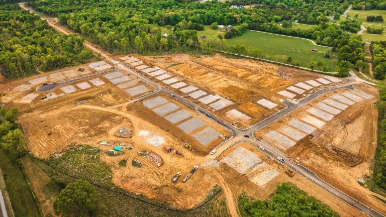
On an active development, drone inspection services for construction typically combine a few deliverables: current-condition topographical mapping overlaid on the approved grade plan, orthomosaic maps of the full property, and scheduled progress photos or video that document each phase before the next trade covers it up.
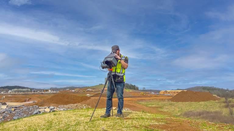
Here’s a very oversimplified version of the workflow: set up a base station, collect ground control points, and fly the site with an RTK-equipped drone. The output might be a contour comparison, a regional volume table, a heat map showing cut and fill variance, or some combination, depending on what the job calls for.
What it doesn’t cover matters just as much: boundary determination, certified site plans, ALTA work, or anything requiring a Tennessee-licensed land surveyor’s stamp. Those stay with your surveying firm. Drone mapping data fills the gaps between those milestones, not the milestones themselves. It’s the check-in between the moments a licensed surveyor is on-site, not a replacement for their work.
Catching Grading Issues Before They Turn Into Rework
Grading errors are expensive precisely because they’re invisible until someone measures them…or part of the project goes wrong. The Construction Industry Institute’s IR-153 dataset, drawn from 144 industrial projects, puts average direct field rework cost at about 5% of total construction value, with the worst 10% of projects hitting 12.4% or higher.
On a 50-lot community, that percentage turns into real dollars fast. For example, our clients who catch off-grade lots early through current-condition mapping report savings of $2,000 to $4,000 per lot that needed correction. It typically pays for itself if even one lot comes back off-grade, and on the developments we’ve mapped, more than half the flagged lots usually are.
Flying the site regularly and comparing current contours against the design grade plan gives your team a documented answer before the concrete crew shows up expecting a grade that isn’t there.
How This Fits a 50+ Lot Community Timeline
Recurring aerial documentation works best on a schedule tied to your project’s pace rather than a one-time snapshot. Weekly or biweekly flights suit fast-moving phases; monthly or quarterly coverage is usually enough once a community settles into a steady build-out rhythm. Either way, the value compounds. Each new flight gets compared against the last, so drift from the grade plan shows up early instead of at final inspection.
Published case studies from firms like Skanska and Brasfield & Gorrie report drone documentation cutting site survey and walkthrough time by 75 to 98% compared to sending a crew out on foot. For a developer managing dozens of lots or even multiple communities, that time difference is the whole point: fewer field hours confirming what’s already built, more time acting on what needs to change.
The same drone capture that verifies grading also gives you time-stamped progress photos and videos for lender draws, GC coordination, and stakeholder updates, without a second site visit. Our construction services are built around exactly this combination.
The Bottom Line
Drone inspection services for construction aren’t a replacement for your civil engineer or your licensed surveyor. They’re the layer that sits between design and delivery, giving land developers a fast, accurate read on whether current site conditions match the plan. For communities where dozens of lots are graded on the same schedule, catching one off-grade lot early usually covers the cost of the entire program, and the documentation doubles as a record you can hand to lenders, GCs, and even prospective clients without scheduling a separate site visit.
If you’re planning topography verification or progress documentation for an upcoming phase, reach out anytime. We typically respond within one business day.