TL;DR: Construction progress photos are scheduled aerial images and video that document exactly how your site looks on a given date. For land developers, they create an objective visual record that keeps lenders, partners, and field crews aligned, answers “what did the site look like in March” in seconds, and protects you if a claim shows up later.
What Are Construction Progress Photos, Exactly?
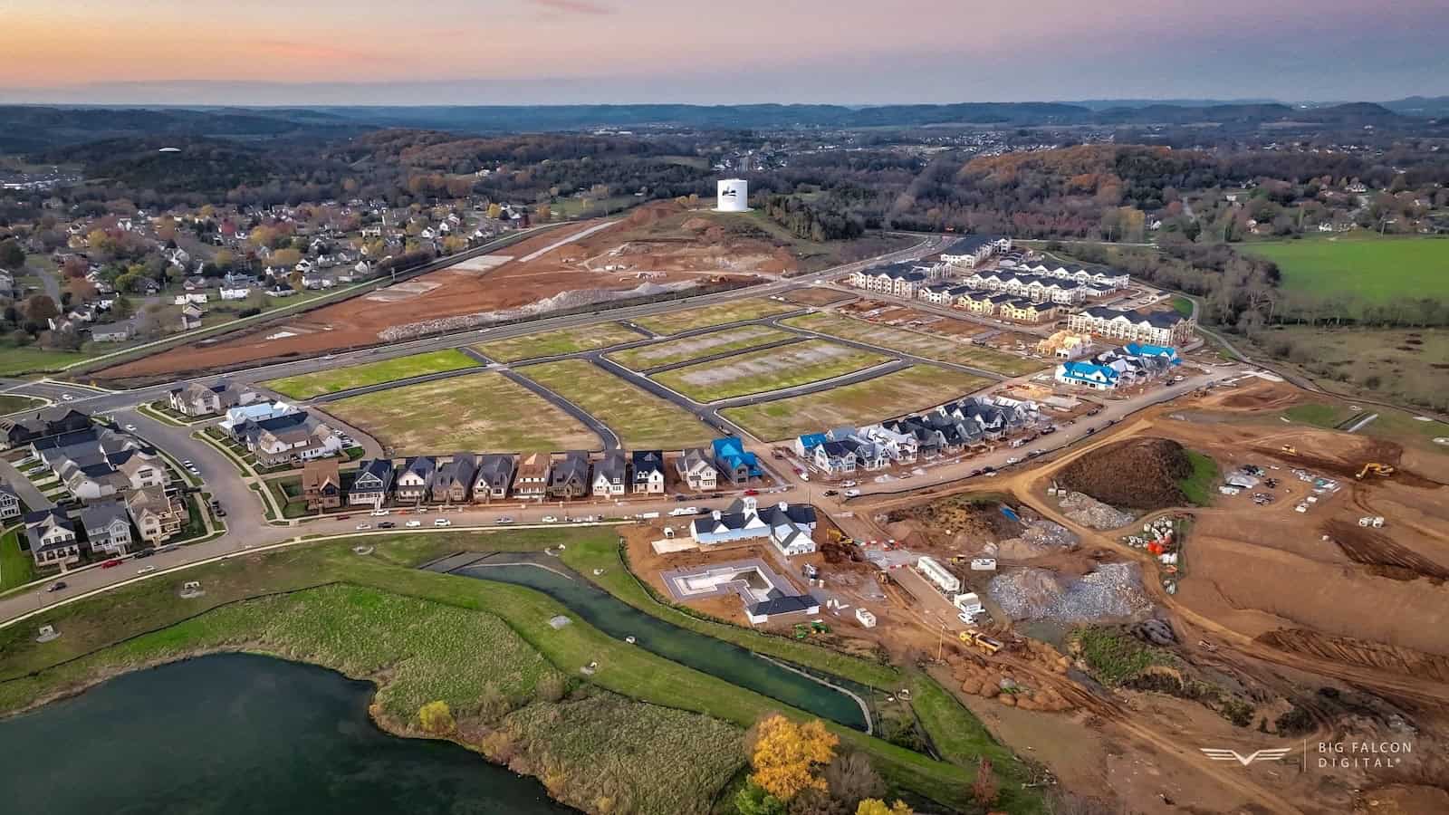
Construction progress photos are more than a phone snapshot from the parking lot. Flown from above on a set schedule, they capture the entire site in one frame: grading, utilities, pad work, vertical progress, and laydown areas.
The value is in the cadence. A single photo is a moment. A series flown from the same angles every week or month becomes a timeline you can scroll through and trust.
That difference matters more than it sounds. A ground-level photo shows one corner of the job. An aerial frame shows how the whole site fits together, which is exactly the view your civil engineer, your lender, and your grading contractor each need when they are not standing on the dirt themselves.
Why Developers Rely on a Visual Record
Construction runs on documentation, and the data on poor documentation is sobering.
Research from FMI and PlanGrid found that poor project data and miscommunication drive 48% of all rework in U.S. construction, accounting for $31.3 billion in rework in a single year. Most of that waste traces back to teams working from information that is missing, outdated, or contested.
Disputes are the other side of that coin. Arcadis reported that construction dispute values remain at historically high levels, with the largest single dispute in its 2022 study valued at $2 billion. When a claim lands two years later, the team with a dated aerial record is in a far better position to back up its timeline.
A clean visual timeline will not erase those risks. It does give you something concrete to point to when memories and paperwork disagree.
How Construction Progress Photos Get Captured
Here is a very oversimplified workflow for how a site gets captured:
- Build the flight plan and, where accuracy matters, place ground control points.
- Fly the site with pre-programmed waypoints so every visit repeats the same paths and angles.
- Process the imagery into the deliverables your team needs.
The repeatable flight path is the part that matters most. Because the drone returns to the same positions on each visit, you get true apples-to-apples comparison shots across weeks and months, not a random pile of angles that are hard to line up.
What You Actually Get
Deliverables vary by job, but a progress capture usually includes some combination of:
- High-resolution still photos from consistent vantage points
- Aerial video flythroughs for stakeholder updates
- Date-stamped images tied to location
- An orthomosaic map or 3D model when you need measurement, not just visuals
You might want all of these or only two. The right mix depends on the questions you are trying to answer that month, and we scope each flight around those questions instead of selling a fixed package.
Who Uses the Photos, and for What
On a 50-lot community, one image set quietly does several jobs at once:
- Lenders and investors see proof of progress without scheduling a site visit.
- Your field team catches issues like drainage or access problems early.
- Sales and marketing get clean aerials of the community taking shape.
- Your records team keeps a defensible archive if a claim ever surfaces.
One flight, several audiences. That overlap is usually where the cost pays for itself.
Getting Started With Construction Progress Photos
You do not need an elaborate program to begin. Most developers start with a monthly flight during active grading and vertical construction, then adjust the cadence as the site changes pace.
If you are weighing whether scheduled construction progress photos fit your project, our drone construction services page shows how aerial documentation works alongside topography verification and volumetric reporting.
The goal is not more photos. It is a record you can hand to a lender, a partner, or an attorney without hunting for it. Construction progress photos earn their keep on the day you need to prove what was true on the ground.
We are based in the Nashville and Franklin area and work with developers across Tennessee. Reach out anytime through our contact page, and we typically respond within one business day.