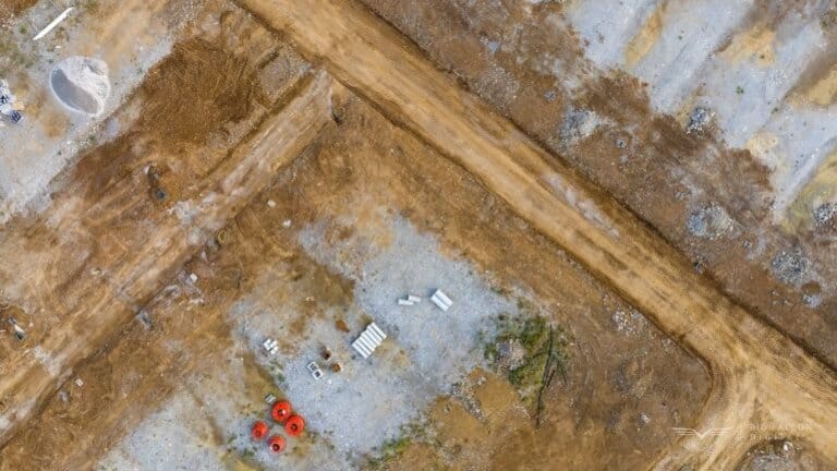
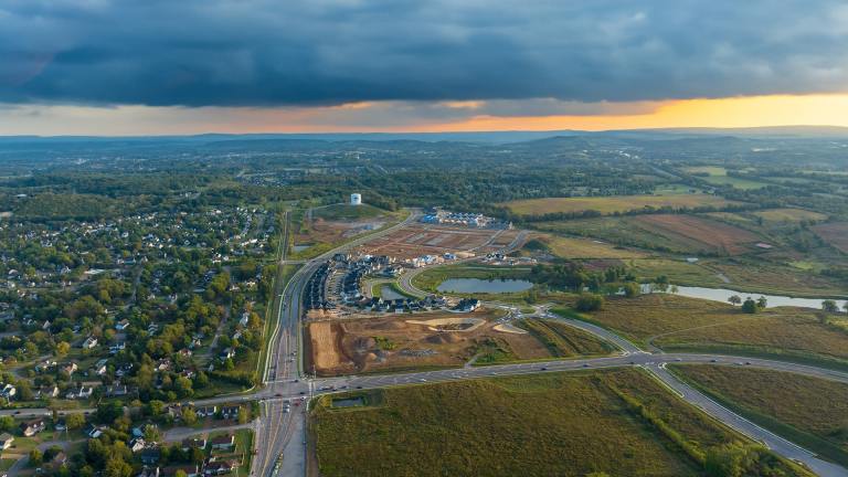
Let’s cut to it. If you’re managing a development site, you already know the biggest risks are the ones you can’t see—or worse, the ones you think you’ve already accounted for. Dirt is one of them. It moves fast, costs add up quickly, and if you’re not tracking it, you’re probably losing money somewhere. That’s where stockpile volume measurements from drones come in.
According to CMiC, it’s one of the fastest, most accurate ways to understand what’s actually on your site, how it’s changing, and who’s responsible for it. We’ve worked with numerous land development managers, and these are the top three reasons they keep calling us back.
1. Verify You’re Being Billed Correctly
Here’s the truth: most invoice disputes happen because nobody actually knows how much material was moved. Your subcontractor gives you a number. You trust it—until the totals start feeling a little off.
With drone-based stockpile volume measurements, we capture high-resolution imagery and turn it into 3D data you can measure down to the cubic yard. No guessing. No back-and-forth.
A mistake of just 5% on 10,000 cubic yards typically costs a minimum of $5,000+, typically much more than one stockpile volume measurement from a drone scan.
What does this mean for you?
- You know how much dirt was delivered or hauled.
- You catch over billing before it hits your budget.
- You back up every pay app with data—not gut feelings.
We’re not out here pointing fingers. But when everyone knows the numbers are being independently verified, accuracy improves naturally.
🧠 Pro Tip: Aerial volume measurements reduce disputes and speed up approvals. It’s good for you and your subcontractors.
2. Keep Crews Accountable and Stakeholders Informed with Routine Stockpile Volume Measurements
Ever get that feeling that something isn’t moving fast enough—but you can’t prove it? That’s where drone data changes the game.
When we fly a site weekly or monthly, we can compare changes in your stockpile volume measurements over time. You see trends. You know if the fill is being used too quickly or sitting idle. You get ahead of problems before they hit your schedule.
Here’s how our clients use this:
- Set expectations with subcontractors using real data.
- Track progress without needing to be on-site daily.
- Show stakeholders visuals and volume changes they actually understand.
Forget spreadsheets. A 3D model with measurable data tells the real story.
📈 Visual proof builds trust. Whether it’s your investor, lender, or project partner, showing progress is always better than explaining it.
3. Track Changes in Stockpile Volume Measurements Monthly for Smarter Planning
You already know that monthly reporting isn’t just for show—it’s how you stay in control. Stockpile volume measurements help you:
- Forecast material needs more accurately.
- Update your haul plans before they go off track.
- Catch material shrinkage or overuse before it becomes a problem.
Some teams wait until the project is halfway through before realizing they’re low on backfill. Others fly the site monthly and get ahead of those shortages by weeks.
If you’re not tracking your material changes over time, you’re flying blind. But it doesn’t have to be that way. A quick drone flight and some smart data processing, and you’ve got everything you need to make faster, better calls.
About Accuracy—Let’s Be Real
No, we’re not surveyors. We don’t stamp plans or file plats.
But what we do offer is highly accurate volumetric data, consistently reviewed and used by survey teams themselves. Our process often saves them days in the field because we give them the raw data they need—clean, precise, and ready to integrate.
In fact, many of our land development clients use us to support their surveyors’ stockpile volume measurements. It’s a smart move when time and budget matter.
Final Thought: If You Have Piles Over 2,000 Cubic Yards, Let’s Talk
Here’s our rule of thumb:
“If your stockpiles are over 2,000 cubic yards, the risk of error is too expensive to ignore.”
A benchmark scan with us is fast, affordable, and often pays for itself immediately. Whether it’s topsoil, aggregate, or spoil, we’ll help you know exactly what’s out there—and what’s not.
📞 Let’s get you a benchmark.
If you’re ready to take control of your site data, especially on big piles, reach out. Even one scan can give you the confidence to make better decisions tomorrow.