When it comes to land development and construction in Tennessee, certain things are non-negotiable. One of them? You must hire a licensed land surveyor for specific deliverables — boundary surveys, certified site plans, ALTA surveys, and anything that carries legal or regulatory weight. But here’s where the industry is shifting: project teams are no longer waiting for just those required moments to understand their site. More and more builders and developers are investing in drone surveys in Tennessee to capture real-time data between those legal survey milestones — and they’re doing it for one simple reason:
It pays for itself.
What the Law Requires: The Role of a Licensed Surveyor
In Tennessee, only a licensed professional land surveyor (PLS) can legally define property boundaries, certify elevation or topographic data, or seal plats for permitting and title. The Tennessee Board of Examiners for Land Surveyors makes this clear: any data that determines legal property characteristics must be produced by a licensed professional.
No matter how sophisticated your drone system is — even with RTK correction, GCPs, and high-end processing — it cannot legally replace that role.
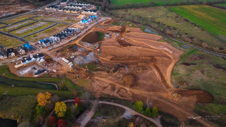
Where Drone Surveys in Tennessee Excel: The Gaps Between Legal Surveys
Here’s what we’re seeing across job sites in Tennessee and beyond:
- Grading crews need to verify slopes before the next cut or fill.
- Project managers want to monitor volumetric change weekly.
- Owners and developers want routine assurance that the site’s topography is aligning with the site plans — not just when a surveyor is required.
And they’re not getting that visibility from boots on the ground with a level and rod.
That’s where drone surveys in Tennessee come in.
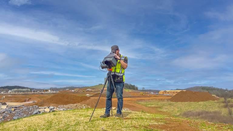
At Big Falcon Digital, for example, our refined systems and industry-praised equipment give us highly accurate data.
One example? A recent job where we and a surveyor both measured the same 3,000-cubic-yard stockpile. Our volume came within 8 cubic yards of theirs — well within tolerance and well ahead of schedule.
Accuracy You Can Trust (But Not Certify)
Let’s be honest: not all drone service providers are equal. So if you’re considering one for your next project, ask them these three questions:
- What accuracy can I expect — and how do you show it?
- What equipment and ground control workflow do you use?
- Can you provide an accuracy statement in your deliverables?
Here’s the catch — and this is important:
For drone surveys in Tennessee, even the most accurate drone data is for reference only. It’s not legally binding. It doesn’t replace a certified surveyor’s stamp.
But it’s often way more reliable than current methods to when a surveyor isn’t available. In fact, we’ve had clients uncover hundreds of thousands of dollars in savings from drone insights — like one project where two scans exposed a $450,000 grading issue and returned an ROI over 10,000%!
The Future Is Layered: Surveyors + Drone Experts
This isn’t an either/or conversation. It’s a layered approach.
- You need a licensed surveyor for the legal phases.
- You should work with a drone provider who understands construction and accuracy — and fills the data gap between those phases.
If you’re building in Tennessee and considering drone surveys, don’t just ask about the gear. Ask about the process, the accuracy, and especially the track record.
Because in today’s construction environment, seeing the site clearly between survey milestones is no longer a luxury — it’s a competitive edge that many are already fully embracing and implementing.
Need a Drone Survey in Tennessee?
We work with builders, owners, and developers across Tennessee to bring clarity to complex sites. Whether you’re planning a cut/fill operation or want to verify final grading, our drone surveys help you catch problems before they become rework.
Start a conversation with us to see just how easy it is to get your first drone survey in Tennessee.