In today’s fast-paced building environment, drone surveys for construction are transforming the way projects are planned, monitored, and completed. Traditional surveying methods can be time-consuming and expensive, but drones offer a faster, more flexible alternative that still delivers accurate, actionable data.
At Big Falcon Digital, we specialize in providing construction-ready aerial insights that help project teams stay ahead. Here’s what you can expect when you schedule a drone survey with us—from site coordination to high-value deliverables like Topo Verification and volumetric reports.
Step 1: Coordinating Drone Surveys for Construction Projects
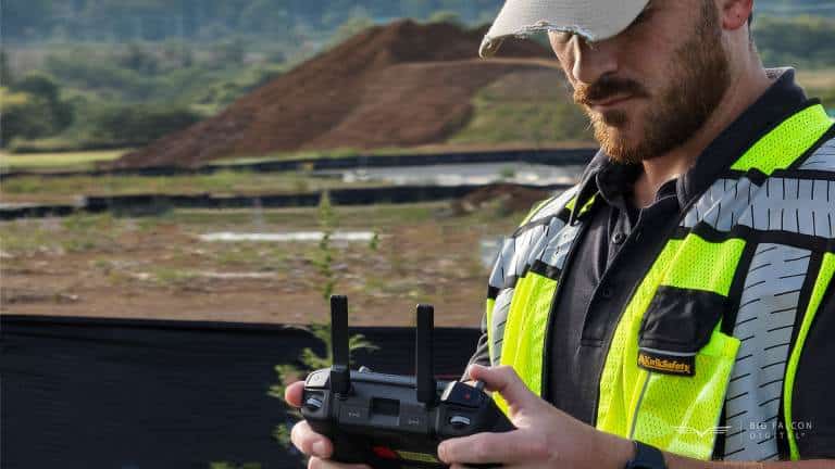
It all starts with a quick conversation. While many drone providers and survey crews require 4–6 weeks just to deploy, Big Falcon Digital can be on-site within one week of your request—and often sooner.
What We Need from You
To begin, we request your site plans—typically grading, utility, or layout drawings with the CAD files. These allow us to overlay your project designs on top of real-world terrain data, so you can confirm that construction is happening to spec.
Because drone flights are weather-dependent, we typically schedule site visits within a 1-week window. This gives us the flexibility to capture clean, consistent data when the conditions are right.
Step 2: On-Site Flight Assessment
Our FAA-certified pilots arrive ready to fly and integrate seamlessly into your construction schedule. Using our processes, most of our drone surveys for construction take just 1–2 hours on-site, depending on the size and complexity of your project.
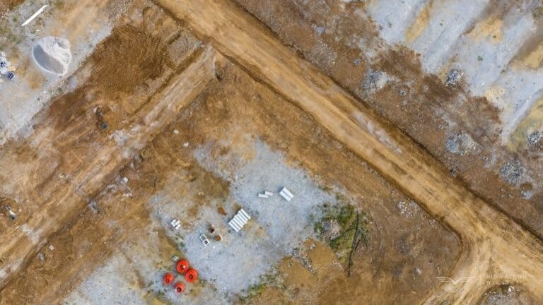
You don’t need to stop work. We coordinate with your team to conduct flights safely while crews continue with their tasks. During this flight, we capture high-resolution images and terrain data used to generate 3D models, topographic maps, and volumetric measurements.
✅ Compliance Note: We follow FAA Part 107 guidelines and ensure full airspace compliance. You can check real-time airspace status with tools like the B4UFLY App.
Step 3: Fast, Construction-Focused Deliverables
One of the biggest pain points in construction is waiting weeks for data you needed yesterday. That’s why we deliver results within 7 business days while many others take 2–4 weeks or more. That’s why not all drone surveys for construction are the same.
Our Two Most Requested Deliverables:
1. Topographic Verification Maps (Topo Verification)
These maps are designed for immediate decision-making. We overlay your site plans (grading, utility, or structural) directly onto the existing site grade, giving you a clear, color-coded visualization of whether or not everything is on track.
Use cases:
- Confirm grading accuracy early
- Identify overcuts or underfills before they become costly
- Align subcontractor work with design specs
These are one of the most common uses of drone surveys for construction.
2. Volumetric Reports
Need to track dirt stockpiles or verify earthwork invoices? Volumetric reports help you measure:
- How much dirt is in each pile
- Changes in stockpile volume over time
- Whether earthwork contractors are moving the right amount of material
This data supports cost tracking, accountability, and progress verification throughout the build. One contractor uncovered a way to save $450K with just two of these reports.
Accuracy You Can Count On (But With Transparency)
Most clients ask for a vertical accuracy of 0.5 feet, but we often deliver our drone surveys for construction with 0.1 to 0.2 feet accuracy, which is considered survey-grade by industry standards.
⚠️ Important Disclaimer: While our workflows are highly accurate, Big Falcon Digital is not a licensed surveyor, and our drone surveys for construction cannot be considered official surveys unless certified by a licensed professional. However, our data is frequently used by survey teams to accelerate their work or verify conditions before conducting their own certified surveys.
Our team uses ground control points and calibrated workflows to ensure high data integrity, making our deliverables a powerful asset in your construction toolkit.
Drone adoption in construction is widespread precisely because it speeds up data capture and improves insight accuracy compared to traditional methods alone (Article by Raken: “Drones in Construction”).
Why Big Falcon Digital for Drone Surveys for Construction?
Here’s how we help your team move faster and smarter:
- Rapid Response: On-site in 7 days or less
- Speedy Deliverables: Processed and delivered in 7 business days
- Practical Accuracy: 0.1–0.2 feet vertical accuracy on most sites
- Construction-Ready Formats: Topo Verification and volumetric insights
- Transparency First: Realistic expectations, proven results
From pre-construction planning to final-grade verification, our drone surveys support every stage of the construction lifecycle.
Ready to Schedule a Drone Survey?
Let Big Falcon Digital help you avoid rework, validate progress, and keep your teams aligned with the real-world site conditions. Our drone surveys for construction are built for the pace and precision your project demands.
👉 Contact us today to begin mapping your sites.
One week from now, your team could have the actionable data it needs to move forward with confidence.